Nexity e-SIP: Mobile Intelligence for Real Estate Consultants
An All-in-One B2B application for Nexity — France's leading real estate developer. Empowering field consultants with Mobile + Tablet tools for the complete sales journey: from prospecting to closing deals.
Nexity, France's largest integrated real estate company, needed a comprehensive digital solution to transform how their field consultants work. The existing workflow relied on paper notes, disconnected systems, and manual data entry — leading to inefficiencies and lost opportunities.
The goal was to create an All-in-One application covering both Mobile (for quick field access) and Tablet (for detailed client management) — supporting the entire sales journey from first contact to deal closure.
Workshop: Defining the Information Architecture
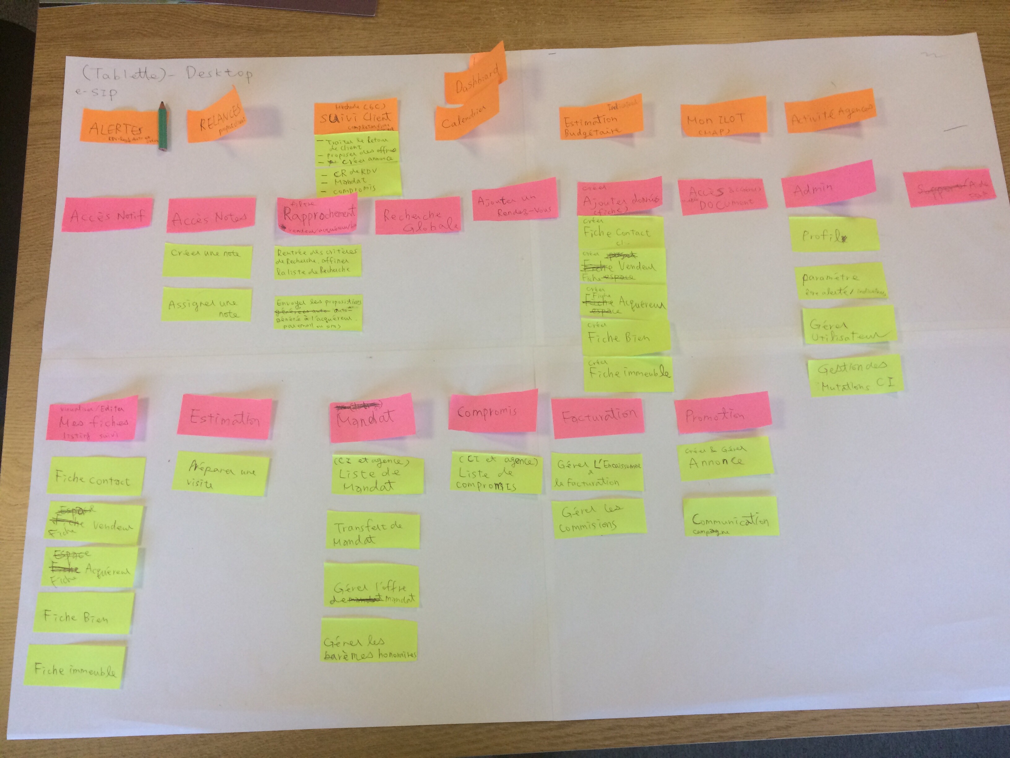
Through collaborative workshops with Nexity's sales team and stakeholders, we mapped the entire sales process. Using card sorting and affinity diagrams, we identified the key user needs and pain points that would shape our design decisions.
The workshops revealed that consultants needed a structured yet flexible system that mirrors their natural workflow — moving from initial contact through to deal closure while maintaining full visibility of client status at every stage.
Process Artifacts
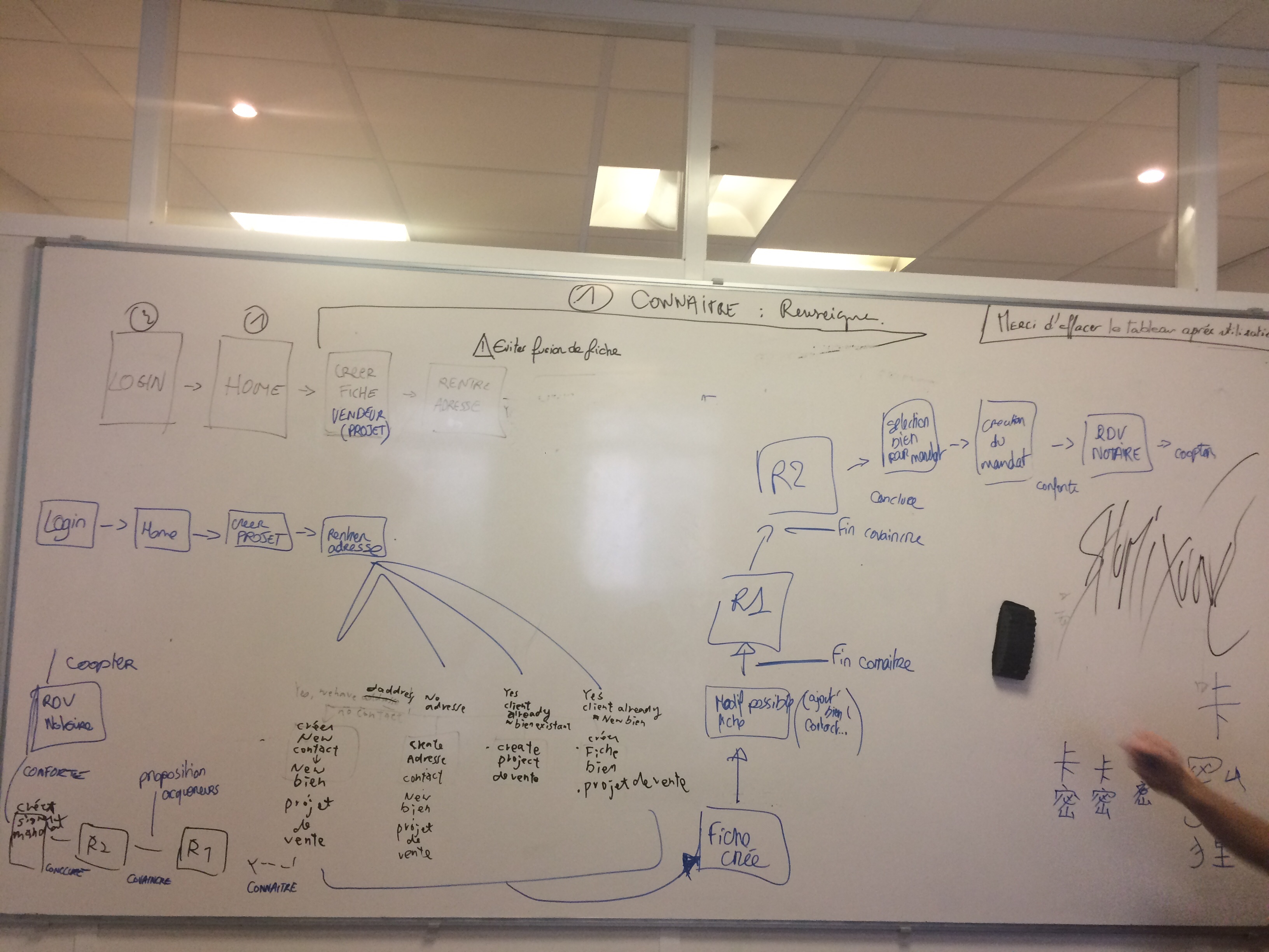
The 5-Phase Sales Journey (5C Framework)
I mapped out the complete seller journey through 5 key phases, following the natural sales funnel from first contact to post-sale retention:
📞
CONTACTER
Create contacts & properties
🔍
CONNAITRE
Understand needs & qualify
💬
CONVAINCRE
Match & convince
✍️
CONCLURE
Close the deal
🤝
CONFORTER
Post-sale support
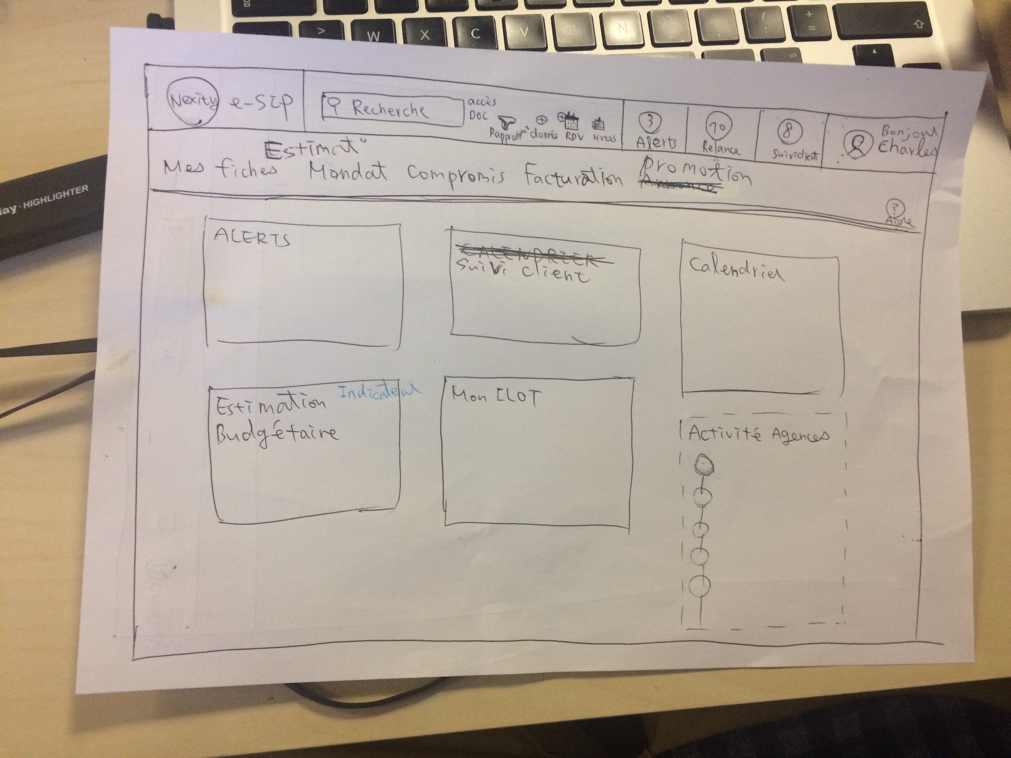
Application Wireflow
Based on our workshop findings, I synthesized the Information Architecture and User Flow into a comprehensive wireflow. Key design decisions included:
- Map-centric navigation — consultants think spatially about their territory
- Single-page Seller Card — all client info visible at a glance
- Progressive disclosure — reveal complexity only when needed
- Cross-platform sync — seamless mobile ↔ tablet experience
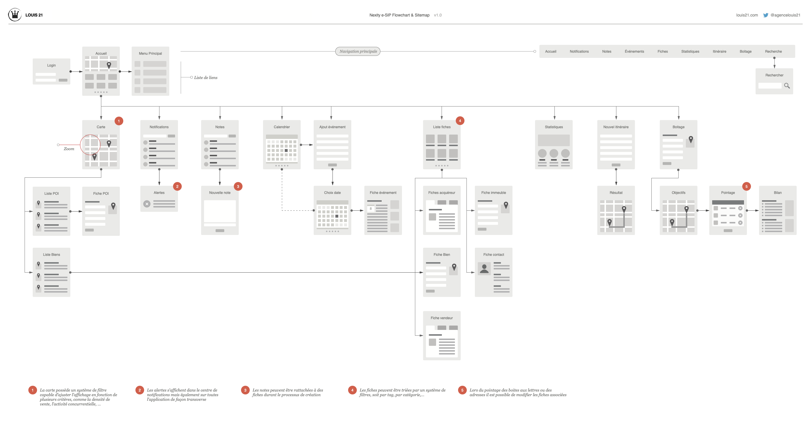
I designed e-SIP (Sales Information Portal) — a cross-platform mobile app built with HTML5 for iOS and Android. The core innovation was a map-first interface that transformed how consultants interact with property data.
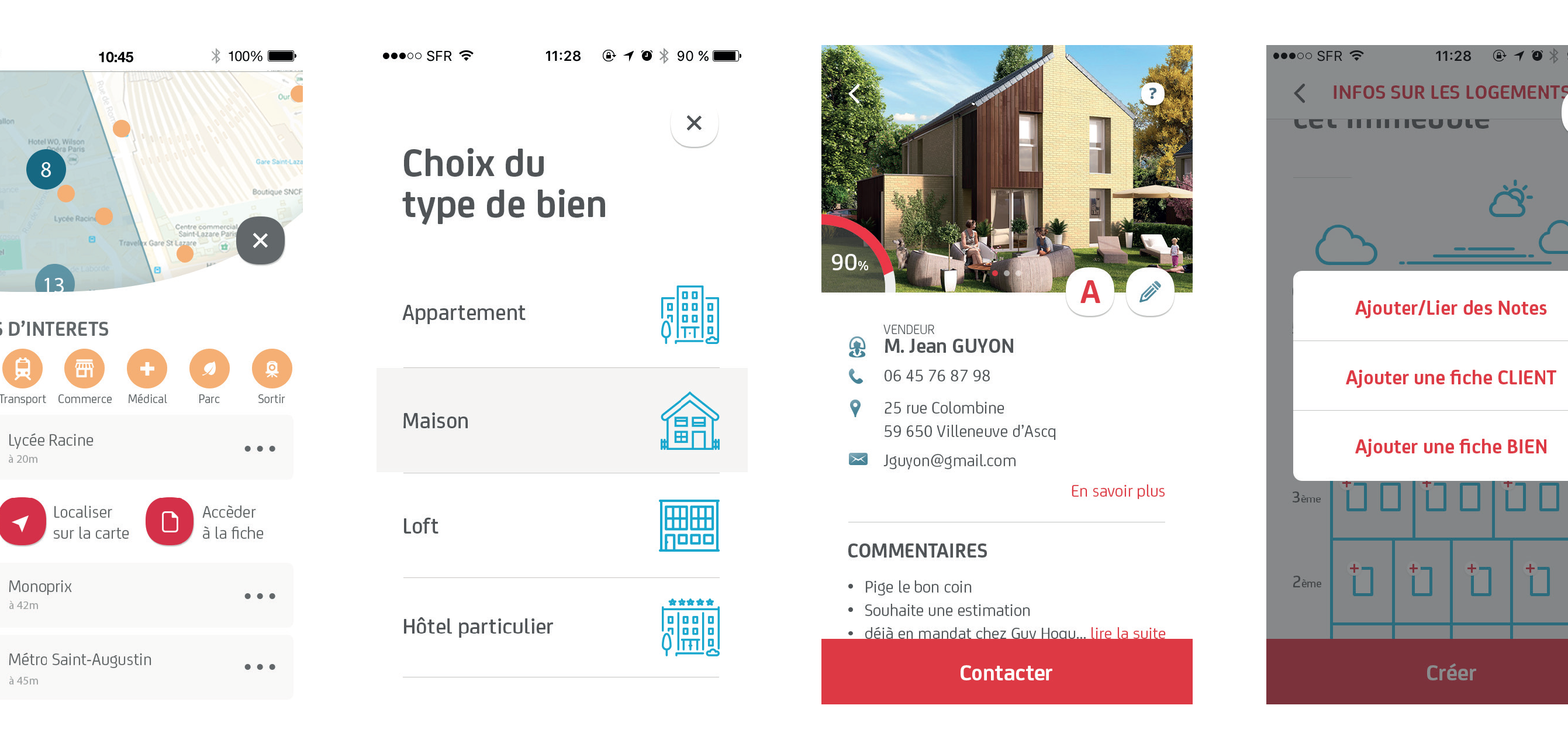
Core Features
📍 Interactive Map
Visualize all properties and points of interest on an interactive map. Color-coded markers indicate property status and type.
🏠 Property Management
Quick access to property details, photos, and status. Add new listings directly from the field.
👥 Client Tracking
Manage client profiles, contact info, and interaction notes. Link clients to properties seamlessly.
🗺️ Route Planning
Plan daily itineraries and optimize field visits. Track progress with real-time location.
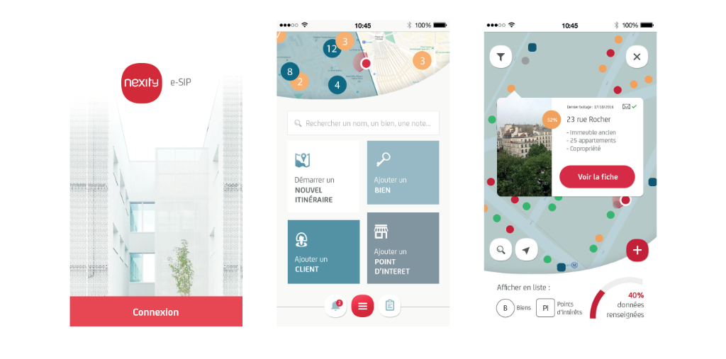
App Demo
Key Screens
- Nexity Red — Brand signature color for CTAs and highlights
- Map-first interface — Geographic context always visible
- Card-based layout — Scannable property and client info
- Status indicators — Color-coded progress tracking
Tablet Developer Demo
As part of the handoff process, I created this interactive demo to show developers the intended interactions and transitions between screens.
The UI follows Nexity's brand guidelines with the signature red as the primary accent. The design prioritizes information density while maintaining clarity — essential for field use under varying conditions.
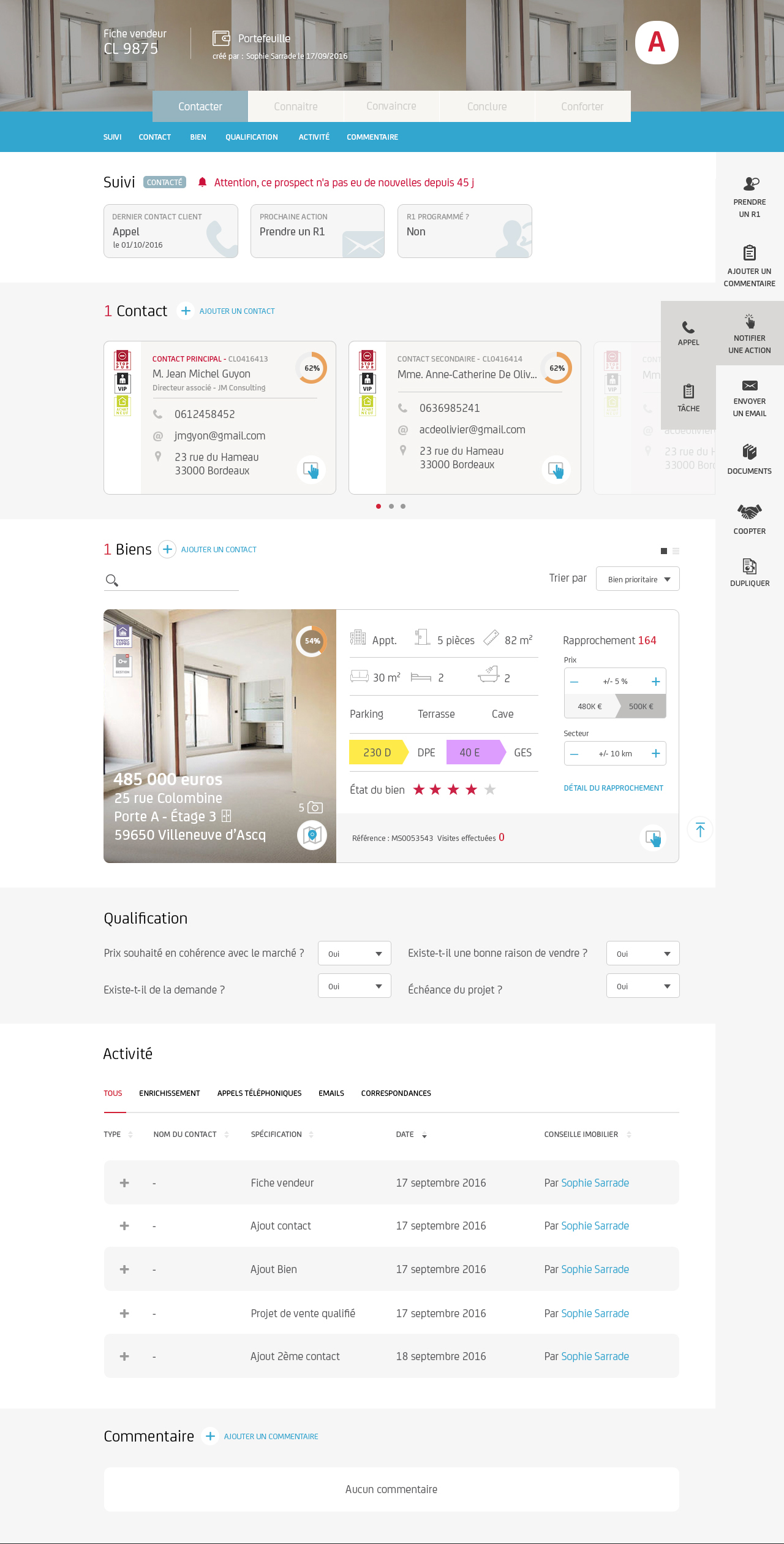
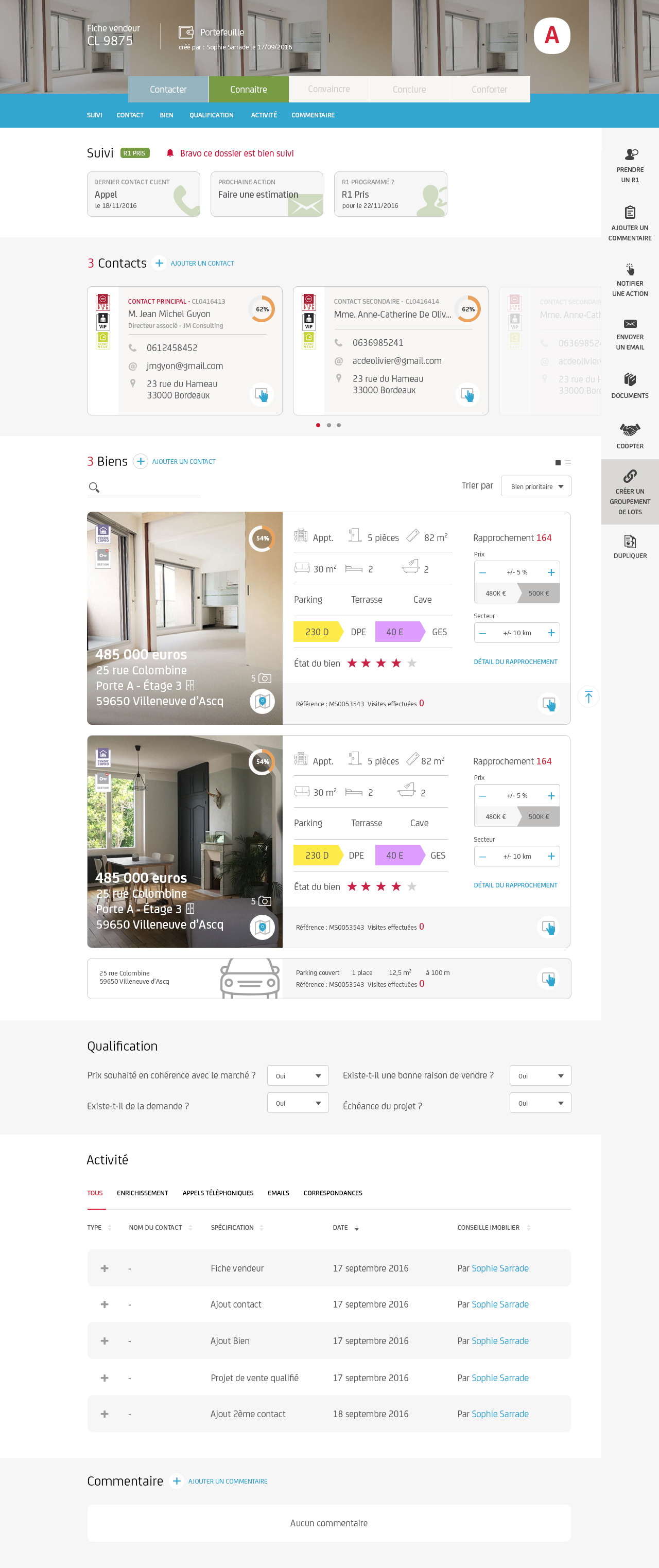
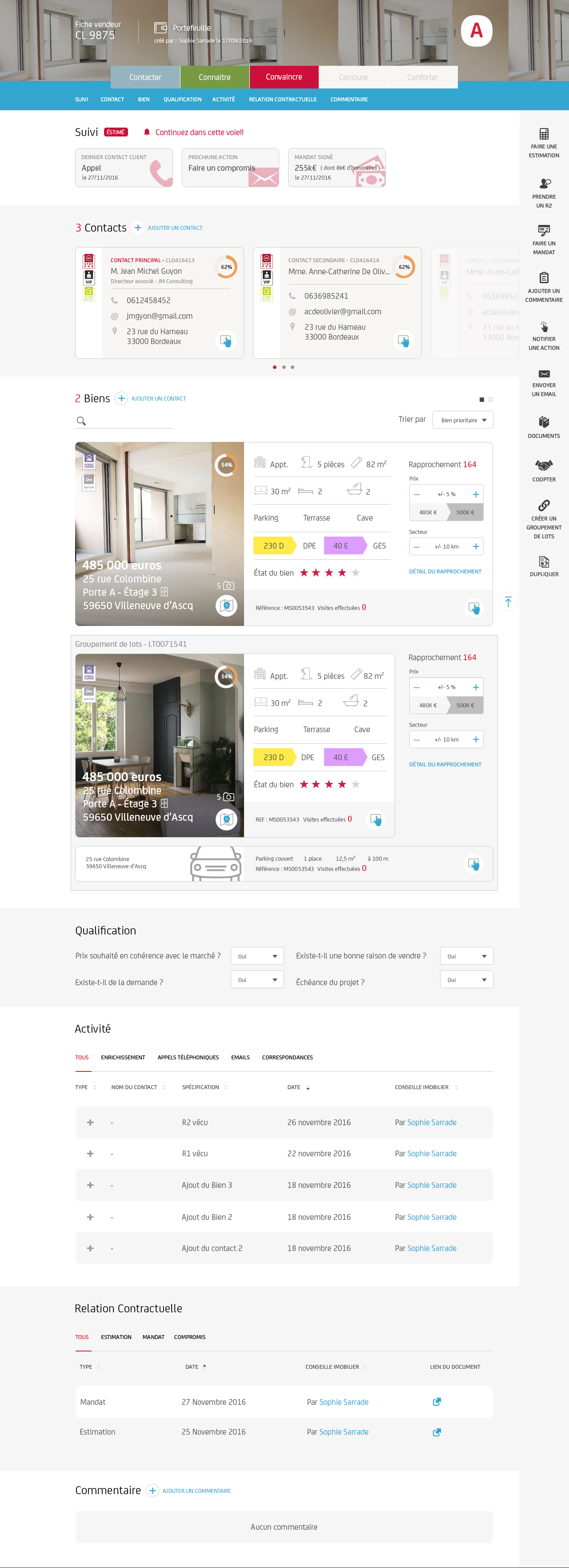
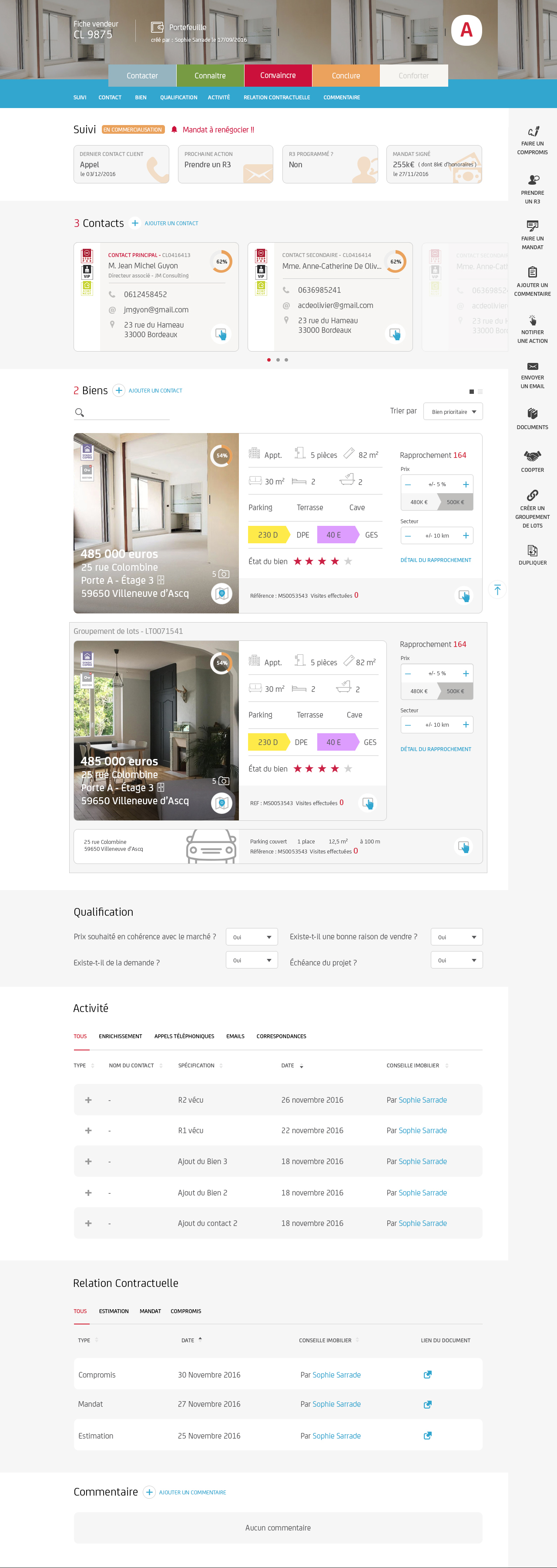
Tablet: Seller Card (Fiche Vendeur)
The tablet version features a comprehensive Seller Card that serves as the central hub for managing each sales opportunity. It displays contacts, properties, qualification status, activity timeline, and contractual progress.
Phase 1: CONTACTER
Phase 2: CONNAITRE
Phase 3: CONVAINCRE
Phases 4 & 5: CONCLURE & CONFORTER
e-SIP transformed the daily workflow of Nexity's field consultants, providing them with a unified tool that replaced multiple disconnected systems.
- Reduced data entry time by enabling on-site updates
- Improved client follow-up with centralized notes and contact management
- Enhanced property discovery through visual map-based exploration